I really like this leg of the trip. I was introduced to some great new state parks and was able to visit one of my favorites - Lake Carlos.
Total Highway Miles this Leg of Trip: 404.8
Total Highway Miles: 2545.0
Total Hiking Miles this Leg of Trip: 11.4
Total Hiking Miles: 61.7
Friday, October 29, 2010
October 9, 2010 - Sibley State Park


Last park of the day. Gotta get back to Minneapolis for my friend Julie's annual party. Look forward to seeing some old friends.
This is a really nice area and the park is a family paradise. Lot's of things for people to do: hiking, biking, horseback riding and canoeing/kayaking. I took the short hike to the observation tower on Mt. Tom and then strolled along the beach. The hike to the observation tower is easy and kids would love the view. The observation tower is very nice. This is another park I need to come back to again. It is only about 100 miles away from NW Suburbs.
Highway Miles from Monson Lake to Sibley: 16.6
Total Highway Miles this Leg of Trip: 305.2
Total Highway Miles: 2445.4
Hiking Miles at Sibley: 0.7
Total Hiking Miles this Leg of Trip: 11.4
Total Highway Miles: 61.7
October 9, 2010 - Monson Lake State Park


This is a nice, simple little park. Very natural. I really like the simplicity of it and saw/heard a lot of birds in the woods. I would think a birder would love this park.
I took a little hike around the interpretive trail. Very relaxing.
Highway Miles from Glacial Lakes to Monson Lake: 35.5
Total Highway Miles this Leg of Trip: 388.6
Total Highway Miles: 2428.8
Hiking Miles at Monson Lake: 1.1
Total Hiking Miles this Leg of Trip: 10.7
Total Hiking Miles: 61.0
October 9, 2010 - Glacial Lakes State Park


This is another fantastic park. The park ranger suggested that I take the hike around the east end of Mountain Lake. It was here that I learned that after 32 parks, I was eligible to get a free night of camping. Thanks to the ranger!!
The leaves had pretty much fallen by the time I got to this park, so I did not get too much in colors. The campground is excellent and overlooks the lake. There are a few camper cabins here for those of you who are like me and love having a campfire, but like a comfy bed to sleep in.
Highway Miles from Maplewood to Glacial Lakes: 100.6
Total Highway Miles this Leg of Trip: 323.1
Total Highway Miles: 2393.3
Hiking Miles at Glacial Lakes: 1.4
Hiking Miles this Leg of Trip: 9.6
Total Hiking Miles: 59.9
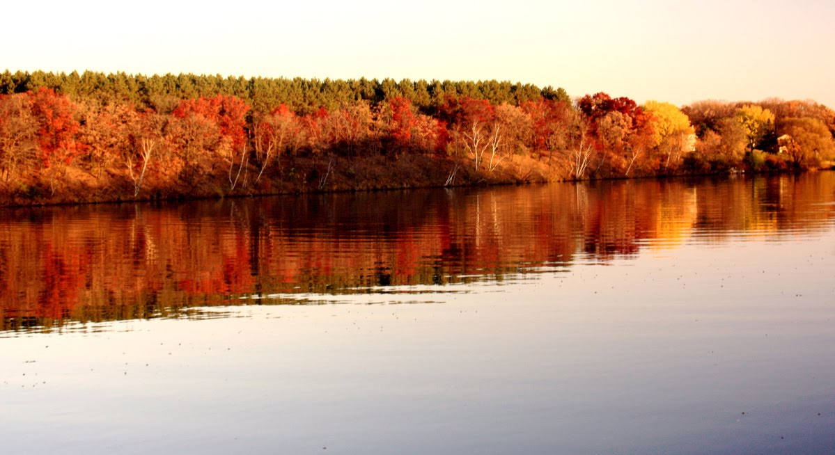
October 9, 2010 - Maplewood State Park


Maplewood State Park is beautiful. I wish I could have been here a little earlier to see the full effect of the fall colors. This is a large park with lots of hiking trails. I asked the park ranger which trail would give me the best view of the park and colors. He said to take the Hallaway Hill scenic hike. This is not a hike for those with less mobility, so make sure you understand their is a sizable hill you need to hike.
The first picture on this entry is of a tree. What do you think it looks like? See the end of the blog to see what my opinion is.
I would like to spend a weekend and look forward to doing that soon.
Highway Miles from Glendalough to Maplewood: 37.7
Total Highway Miles this Leg of Trip: 232.5
Total Highway Miles: 232.5
Hiking Miles in Maplewood: 1.2
Total Hiking Miles this Leg of Trip: 8.2
Total Hiking Miles: 58.5
October 9, 2010 - Glendalough State Park

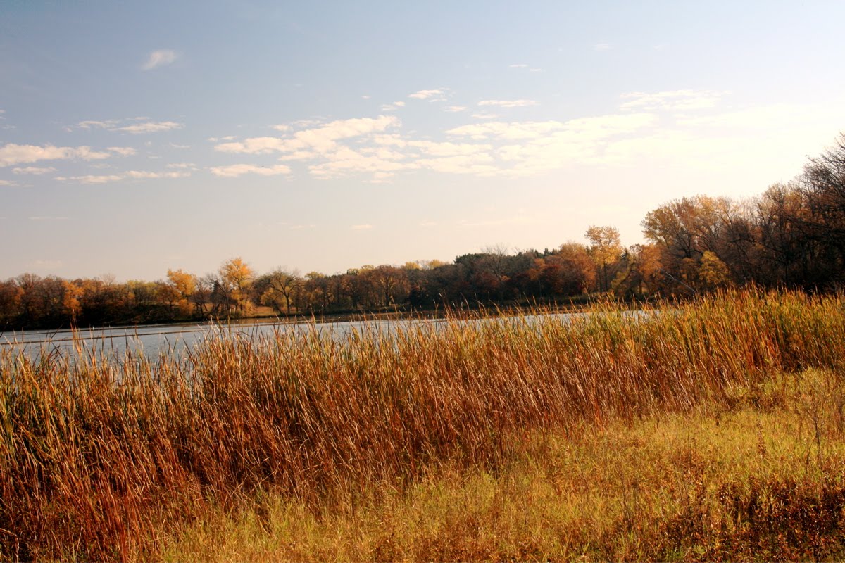


At first this park was a little deceiving for me. It did not seem like there was much here at the entrance. As I drove a little further in, I found that this was a very scenic park with a transition of prairie to forest. The history of this park if very impressive also as it appears that several famous people came here to hunt, including US Presidents.
I took the Sunset Lake Trail along with several partial hikes around Annie Battle Lake to the south and north.
Highway Miles from Lake Carlos to Glendalough: 38.4
Total Highway Miles this Leg of Trip: 194.8
Total Highway Miles: 2255.0
Hiking Miles at Glendalough: 1.6
Hiking Miles this Leg of Trip: 7.0
Total Hiking Miles: 57.3
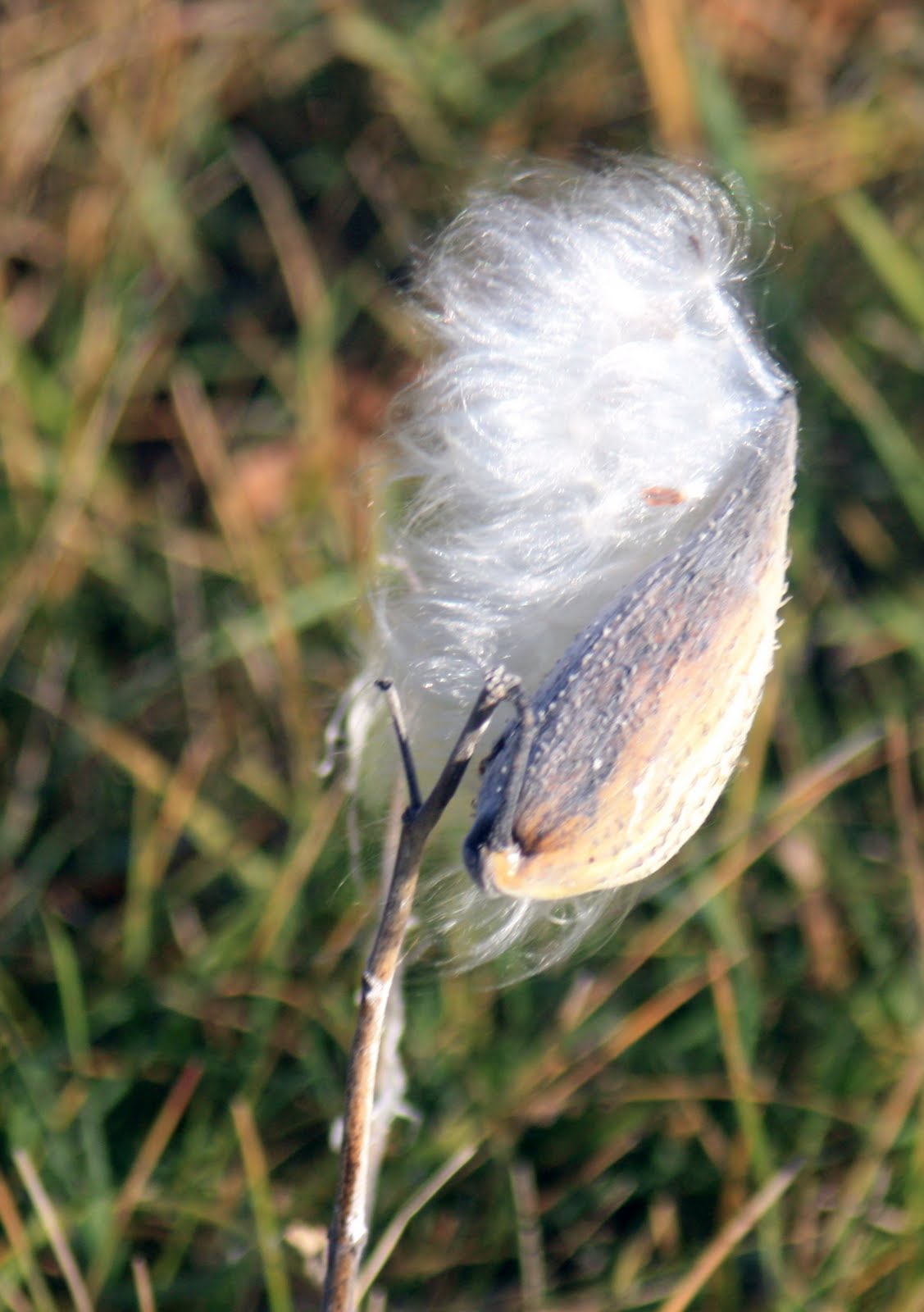
October 8-9, 2010 - Lake Carlos State Park


I decided to spend the night at Lake Carlos. Last time I was here it was rainy and our boat, which we left on the beach, got swamped by the waves. But we still had fun since this is such a beautiful park.
I started a fire to help me see as I was putting up my tent in the dark. Good thing I know the tent well and it only took me a few minutes longer than normal. Again, when outside of the Twin Cities, it is amazing how many stars you can see without all of the light pollution.
I woke up early the next morning to a wonderful sunrise over the lake. I was able to get in a great hike to start my day off. The group camp is amazing and would recommend any group to utilize these facilities. It is so nice getting up early to see and hear the wonders of the woods. I took the Hidden Lake Trail along Lake Carlos and did part of the Maple-Basswood Interpretive Trail.
Highway Miles from Lindbergh to Lake Carlos: 58.2
Total Highway Miles this Leg of Trip: 156.0
Total Highway Miles: 2215.6
Total Hiking Miles Lake Carlos: 2.5
Total Hiking Miles this Leg of Trip: 5.4
Total Hiking Miles: 55.7
October 8, 2010 - Charles Lindbergh State Park


This is a very historic park. Since I was getting there very late, the museum and houses were closed. However, I was able to take a little hike to see the nature of the park.
Highway Miles from Lake Maria to Charles Lindbergh: 64.6
Total Highway Miles this Leg of Trip: 97.8
Total Highway Miles: 2157.4
Hiking Miles at Lindbergh: 1.0
Total Hiking Miles this Leg of Trip: 2.9
Total Hiking Miles: 53.2
October 8, 2010 - Lake Maria State Park


Due to the closing of Fort Snelling because of flooding, my Little Brother and I decided to go to Lake Maria instead. Neither of us were disappointed with the decision.
As usual, when we got there we talked with the ranger on-duty to find a good hike. She recommended that we take the Bjorkland Lake Trail. We started on our hike and decided to take the Interpretive trail route to read and learn about the forest. We then hooked up with the Bjorkland Lake Trail. This is a relatively easy trail to hike and we found out a lot about the trees, wildlife and the history of the area. I also found out he had a budding interest in photography. Ah, another thing in common.
After our 1.5 mile hike, we drove down to Lake Maria and walked along the lake. The lake was up quite a bit, again due to the rains. My Little Brother being a kid decided to take advantage of the water and muck and proceeded to get a little muddy.
This is a great state park which is really close to the Twin Cities. It is about a 40 minutes from the NW Suburbs and for those that don't like to camp, they have a camping cabin for your comfort.
Lastly, I love being a Big Brother. If you are interested in becoming a Big Brother in the Twin Cities area or elsewhere in the USA, contact Big Brothers Big Sisters at www.bbbs.org.
Highway Miles from Home to Lake Maria: 33.2
Total Highway Miles this Leg of Trip: 33.2
Total Highway Miles: 2092.8
Hiking Miles at Lake Maria: 1.9
Total Hiking Miles this Leg of Trip: 1.9
Total Hiking Miles: 52.2
Friday, October 8, 2010
October 8' 2010 - Fort Snelling State Park
I am excited about my hike today at Fort Snelling. I am being joined by my little brother Junior on the hike. I am so glad that he likes the outdoors and hiking. We will have a blast.
Wednesday, October 6, 2010
October 4, 2010 Home
1 mississippi, 2 mississippi, 3 mississippi....10 mississippi. Starting with leaving Itasca State Park, I crossed the Mississippi 10 times on my way back to the the Twin Cities. Maybe the Great River Road route would be another adventure I can do in the future.
After being back a few days. I am entering this on the October 6 and reviewing what I did in a day and a half, I can now see why my legs hurt like all get out!!!! 14.5 hiking miles!!! There is something wrong with me because I totally enjoyed it. I did a little hiking today to work the kinks out. Felt guilty that I did not walk yesterday, but got over it very quickly.
Highway Miles from Crow Wing to Home: 102.5
Total Highway Miles this Leg of Trip: 565.1
Total Highway Miles: 2059.6
Hiking Miles this Leg of Trip: 14.5
Total Hiking Miles: 50.3
Total Hiking Tower feet climbed: 200 feet feet in the air.
Total Feed underground: 2341 feet below the surface.
Wow, this is a lot of fun. Thanks for following my blog.
Troy
October 4, 2010 - Crow Wing State Park


This was another wonderful park. However, you could hear the shelling and shooting from Fort Ripley. At first I thought it was a giant woodpecker, then I got my bearings on how close the fort was to this park.
I took two hikes in the park. One in the picnic area along the Red River Oxcart Trail for 1.0 miles and the other hike was along the Mississippi River on either side of the boat launch, total of 0.7 mile.
I might have been better being here a week earlier, but it is still a beautiful park. Enjoy the pictures. Oh year, I did startle two grouse and saw 4 wild turkeys in this park.
Miles from Cuyuna Country to Crow Wing: 25.9
Total Highway Miles this Leg of Trip: 462.6
Total Highway Miles: 1957.1
Hiking Miles at Crow Wing: 1.7
Total Hiking Miles this Leg of Trip: 14.5
Total Hiking Miles: 50.3
October 4, 2010 Cuyuna Country State Recreation Area


As a Boy Scout, I came up to this area each summer for camp. It was a great time where I learned a lot about life and nature. I even got lost in the woods one evening for a special ceremony. I was able to find my way out using the skills that I learned. Using my topographical map and compass, I was able to find the main trail to get me back to the main camp. Good thing that it was only 200 yards away. 8-)
However, what I found in Cuyuna Country was not what I expected. Don't get me wrong, it was a wonderful surprise. Cuyuna Country represents the open pit mines throughout this area. This pit mines are now filled with water and provide opportunities for trout fishing, hiking and mountain biking.
If you are a mountain biker, this should be paradise for you. I saw tons of trails as I was hiking through the area. After talking with my friend Chris, I also found out that many scuba divers do their open water test here or do dives to the depths of these lakes.
Total Highway Miles from Lake Bemidji to Cuyuna Country: 110.2
Total Highway Miles this Leg of Trip: 436.7
Total Highway Miles: 1931.2
Hiking Miles in Cuyuna Country: 0.5
Total Hiking Miles this Leg of Trip: 12.8
Total Hiking Miles: 48.6
October 4, 2010 - Paul Bunyan and Babe


A trip to Bemidji is not complete without getting your picture with Paul and Babe. I set up my tripod and hit the 10 second time to take 10 consecutive shots. Ran to the place I was going to pose and did a little jig as the shots were taken. Enjoyed being goof!!
October 4, 2010 - Lake Bemidji State Park


After getting my food at Harmony Co-op, I drove to Lake Bemidji State Park. I stopped by the office to see where I could take a hike after lunch. Amber suggested that I take the short trail to the highest point overlooking the lake. It is about a 1 mile round trip hike. After eating the wonderful soup and hot ambrosia, I took the hike to the point. It was a windy day, so the waves were white capped. I came back to my picnic site and went about a 1/2 mile the other way. I walked over the boat ramp/marina bridge into creek area fed by Osprey Pond.
For hikers, there are a lot of trails throughout the park with varying levels of difficult. In fact, the bog trail is accessible. I had to hold myself back from doing the bog trail. So much diversity of flora and wild life in bogs. Next time.
If you are a biker, the Paul Bunyan State Trail runs on the eastern edge of the park. It runs 110 miles from Brainerd Lakes area up to Lake Bemidji State Park where it becomes the Blue Ox Trail.
I was shuffling my feet through the leaves as you did when you were a kid back to my car. Loved the sound of it, but it was a compelling reminder that I have a lot of raking ahead of me at home.
Total Driving Miles from Itasca to Lake Bemidji: 39.4
Total Driving Miles this Leg of Trip: 326.5
Total Driving Miles: 1821.0
Total Hiking Miles Lake Bemidji: 1.5
Total Hiking Miles this Leg of Trip: 12.3
Total Hiking Miles: 48.1
Comments
Hey, I see people are reading my blog which is really cool. Please comment on things you would like to see me write about or ask questions of certain things I talk about or photos that I took. I specifically do not write about each photo with where it was taken in each park or when. I do this because I want you to find your own picture in the park when you go there.
Comments, please!!
Comments, please!!
October 4, 2010 - Bemidji, MN Seeking some soup for the soul.
As I was driving from Itasca to Lake Bemidji State Park, I realized I was hungry. Not just for anything, but soup and something wholesome. When I got to Bemidji, I drove around downtown to see if I could find a little cafe that stood out. Seeing a couple of locations, but not quite satisfied with my exploration, I drove around a little more.
Much to my surprise, I drove by the Harmony Co-op twice before actually seeing it. Being a fan of co-ops and natural/organic foods, I decided to take a chance they may have a good soup at the deli. As with all co-ops, I was greeted by a warm smile. I asked if they had fresh soup at the deli and the person walked me straight back their and introduced me to Kay, the Deli Manager. Kay asked me if I liked spicy foods. Yep!! She said I was in luck. Today their soup was Texas Three Bean soup and gave me a sample to try. Winner, Winner, Soup's for Dinner!! (In parts of MN, lunch is called dinner and supper is the night time meal)
Wanting a little more than a cup of soup, I browsed around a little more and found hummus, a rice noodle pasta, wraps and other fresh, organic options. Kay again came to my rescue by introducing my culinary taste buds to hot (spicy) Deli Ambrosia. Now that's what I am talking about!!! This is so good. I asked if she had an flat bread to go with it. She did but it was all frozen. Instead, we chose a Sesmark rice cracker. To finish off my lunch, I got some organic green tea.
Thanks Kay for all of the great suggestions. To learn more about Harmony Co-op either go to 117 3rd Street NW in Bemidji or visit them online at www.harmonycoop.com
I then drove to Lake Bemidji State Park to have my lunch on the shores of the lake.
October 4, 2010 - Itasca Headwaters - David & Rita

When I stopped by the Mary Gibbs Mississippi Headwaters Center to see if they had any cool bumper stickers, I wasn't expecting to meet a charming couple from England. Walking around the gift shop, I overheard a man with a British accent speaking with the cashier. Since I did find something that I liked, I walked up to the register to pay for it.
Naturally, I inserted myself into the conversation to learn more. I found out that David and Mary were traveling the Wisconsin, Upper Michigan and Minnesota area for 4 weeks. (Okay, commentary on the way: What the heck do the European folks do that they get 4, 5, 6 weeks at a time to go on vacation. corporate america would get rid of you if you even considered a 2 week vacation)
They flew into Chicago and went to Milwaukee. Since I love this city, I wanted to hear more. They said they were downtown talking to a man and he suggested they visit the Safe House. I had a smile on my face since I have been there and it is a must do. Because many people have not been there, I cannot tell you the rest of their story at The Safe House. But go, you won't regret it. ;-)
We talked a little more and I went on my way to the Headwaters of the Mississippi. I ran into David and Rita again down at the headwaters. We talked between shots and I found that they have been to the USA several times in the past seeing Mesa Verde, Estes Park, Seattle, Grand Canyon and many other national treasures in the country. I could ramble on forever about our conversation, but I won't. Hoping to meet up with David and Rita when I go to England. I really encouraged them to visit Minneapolis next time they are in Minnesota. They said they would consider it.
I have a quick snapshot I took of David crossing the Mississippi. Cool.
Tuesday, October 5, 2010
October 4, 2010 - Itasca State Park


I finally did it. I stayed at Hostel last night in Itasca State Park. I got there very late due to a long hike at Savanna Portage. Thanks to Sara, the Hostel Manager, she waited up for me to check in.
The hostel was everything and nothing that I expected. I knew that the beds would be small in a dorm style room. I anticipated common rooms for eating, meal prep and hanging out. What I did not expect: no one was there. But then again, it was a Sunday night in October. I was really looking forward to meeting people as part of my hostel experience. Maybe next time.
Being a hostel, they focus on living green. Recycling, minimal appliance use, energy efficient lights and water saving shower heads. They also focus on minimal outside light pollution. Boy, it was great to see ALL of the stars. Need to book a week here during the Perseid Meteor Shower next August.
On to my visit of the park..... As you can imagine, this late in the season, a lot of the park amenities are closed. But that was not a problem for me. Goals were to get a good hike around the lake; look at the fire tower and decide if I wanted to climb it; and go to the headwaters of Mississippi.
I first took a tour of the wilderness drive via automobile. This would have been a great bike ride!! I stopped by the observation tower, walked the 0.6 mile round trip hike to get there and stared at it for about 10 minutes. I guess 2 out of 3 isn't bad. But there was no way I was going to climb it this time. Thighs ached from 7.2 miles of hiking and a 100 foot climb to the top of observation tower at Mille Lacs Kathio yesterday. I know, chicken!
I then proceeded to the Douglas Lodge area and hiked the Dr. Roberts trail along the east arm of Lake Itasca. This two mile loop is easy and provides you with limited clear views of the lake. I still enjoyed it just the same. Nice getting out early on a Monday, no humans around to provide noise pollution with loud yells. (see below at the headwaters)
I then decided to check out the visitor center. This center was very nice. Good interpretive information and even saw a bridal party getting ready for a wedding on the lake. Wedding Crashers came to mind. ;-). But I was on a mission.
The Headwaters of the Mississippi: Got to this visitor center and during my look around, I met David and Rita from Bury St. Edmund, England. See separate blog entry titled "David and Rita".
I hiked the 800 feet down to the headwaters. As I was approaching, I heard a lot of yelling and loud voices, full of excitement. I really expected to see a group of teenagers and much to my surprise it was a group of older women carrying on like a bunch of ninny's. I could tell that several of the other people at the headwaters were also irritated with this commotion at a reverent site. (okay, off the old soap box).
I love this area. I know everyone likes a beginning, but this is the beginning of it all for the Mississippi. I have been here several times with several different people; family, friends and girlfriends, but it never gets old seeing how it all starts. Pictures will do it more justice.
Highway Miles from Savanna Portage to Itasca: 129.3
Total Highway Miles this Leg of Trip: 287.1
Total Highway Miles: 1781.6
Hiking Miles in Itasca: 3.6
Hiking Miles this Leg of Trip: 10.8
Total Hiking Miles: 46.6
Subscribe to:
Posts (Atom)